

Lands in this corner of Oregon protected by the Oregon Department of Forestry are once again at “moderate” fire danger as of Tuesday morning.
Due to high temperatures, fire danger on the east side of the Tillamook State Forest was set to high Thursday morning before being placed back at moderate at 12:01 a.m. Tuesday.
That means:
-Campfires are only allowed at designated camping sites
-Dispersed campfires is not allowed
-Motorists traveling on forest roads are required to have a shovel and one gallon of water or a 2.5 lb. or larger ABC fire extinguisher
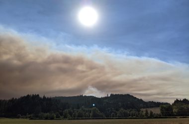
Summer may close to ending, but fire season continues across the state, and an outdoor burning ban for most types of burning remains in place across Washington County.
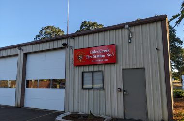
The NWOFPA region includes much of the regions of Gales Creek, Buxton, Timber, Manning, and the Tillamook State Forest, among other areas. It stretches north to the Columbia River, west to the Pacific Ocean, south to Sheridan, and east to parts of Gales Creek, the Killin Wetlands outside of Banks and to Scappoose. Locations in and within 1/8 of a mile of the NWOFPA region are considered lands protected by the ODF.
The public and industrial users of local forests can stay informed of current fire restrictions by visiting the agency’s Fire Restrictions & Closures website or calling their local ODF or protective association office, in this case, Forest Grove ODF offices for most of our readers at 503-357-2191. Up-to-date recorded information on burning can also be found by dialing 503-325-7215.

Chas Hundley is the editor of the Gales Creek Journal and sister news publications the Banks Post and the Salmonberry Magazine. He grew up in Gales Creek and has a cat.